
Colts Crossing Area Structure Plan
Diamond Valley, AB
We have applied for an Area Structure Plan for a new community (Colts Crossing) within Diamond Valley located east of the Kaiser lands. The new community will provide for new commercial, industrial and residential land supply growth over the next 20 – 30 years.
This project is envisioned to accommodate:
- Diverse range of housing options including townhomes, semi-detached, and detached homes
- Diverse offerings of commercial and industrial businesses
- Parks, trails, and open space
A copy of the updated version of the ASP can be found here.


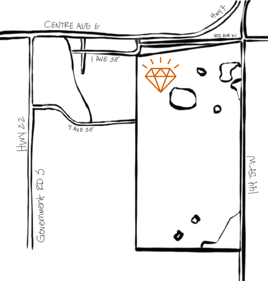
PROJECT LOCATION
WHAT IS BEING DEVELOPED?
The land is envisioned to have residential, commercial and light industrial centered around high-quality parks and open spaces connected through a trail system across the subject site.
PROJECT DETAILS
Parcel Area
122 Ha
Existing Land Use
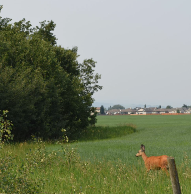
Currently, the site is vacant of development and used as farmland.
Proposed Land Use
The new community will host a variety of development opportunities including commercial and residential parcels.
PUBLIC ENGAGEMENT PROCESS
QuantumPlace Consulting hosted an in-person open house at the Flare N’ Derrick Community Centre on November 28, 2023. This open house was an opportunity to learn more about this application. The event ran from 6:30 to 8:30 pm MDT, during which the QuantumPlace team fielded questions and comments on their Conceptual Scheme concept. You can view these questions and comments and how QuantumPlace responded at the link here.
COMMUNITY PROGRAMMING CONCEPT
Focusing on specific design aspirations is essential to creating highly livable and vibrant spaces in the future community of Colts Crossing. The programming features shown below illustrate a design vision that reflects connectivity, dynamic spaces and conservation of western charm.
The Community Programming Concept illustrates how programming of different design aspirations could occur in the community of Colts Crossing.
Streetscapes
Streetscapes address the boulevard and landscapes along the roadways in the community.
Streetscapes address the boulevard and landscapes along the roadways in the community.
Municipal/School Reserves
Municipal Reserves are public park spaces which include trails, recreation facilities and natural areas.
Municipal Reserves are public park spaces which include trails, recreation facilities and natural areas.
Joint Use Site
The Joint Use Site is the location where a public school could be constructed at a future stage. These are also part of the Municipal Reserves contribution.
The Joint Use Site is the location where a public school could be constructed at a future stage. These are also part of the Municipal Reserves contribution.
Pavilions & Shade Structures
Pavilions & Shade Structures refer to organized spaces in an area. These can include covered seating areas, picnic sites, lookouts, and shade structures.
Pavilions & Shade Structures refer to organized spaces in an area. These can include covered seating areas, picnic sites, lookouts, and shade structures.
Trails, Paths & Wayfinding
Trails refer to spaces designed to be traveled through – and provide pedestrian paths through the community.
Trails refer to spaces designed to be traveled through – and provide pedestrian paths through the community.
Playgrounds
Playgrounds offer a local community destination where families can congregate at to enjoy a shared recreational experience.
Playgrounds offer a local community destination where families can congregate at to enjoy a shared recreational experience.
Future Right-of-Way
The Future Right-of-Way will be developed by others at a future stage if required. Until that time, it will be green space.
The Future Right-of-Way will be developed by others at a future stage if required. Until that time, it will be green space.
Stormwater Management Facilities
Storm Water Management Facilities are the areas designated to manage stormwater within the community.
Storm Water Management Facilities are the areas designated to manage stormwater within the community.
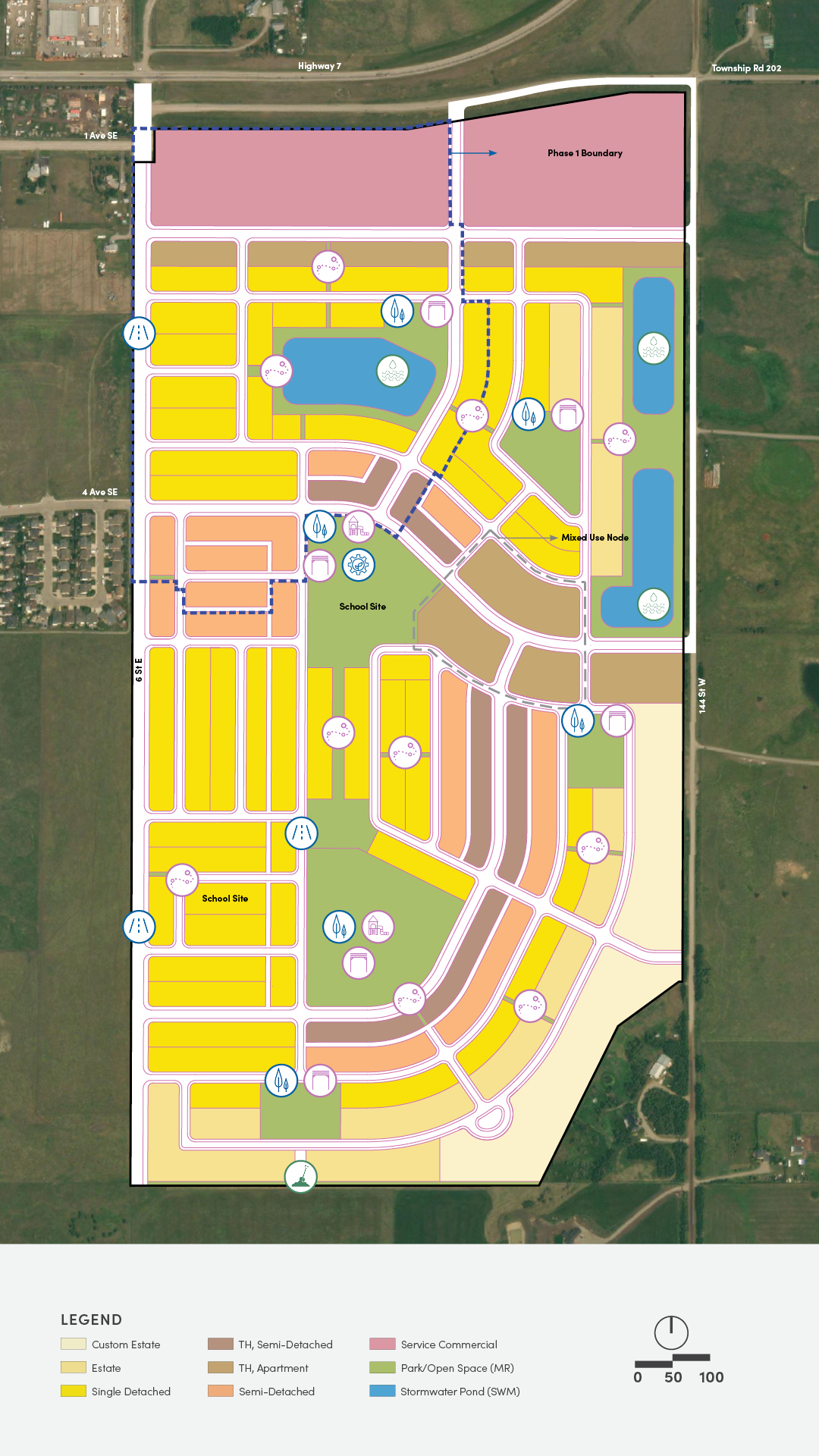
PHASE 1
Phase 1 of the Colts Crossing community will be vibrant and comprehensively planned, to add to the vitality of Diamond Valley while respecting the natural beauty of the surrounding environment. The land use strives to strike a balance between flexibility and certainty, while allowing for opportunities to respond to changing market conditions.
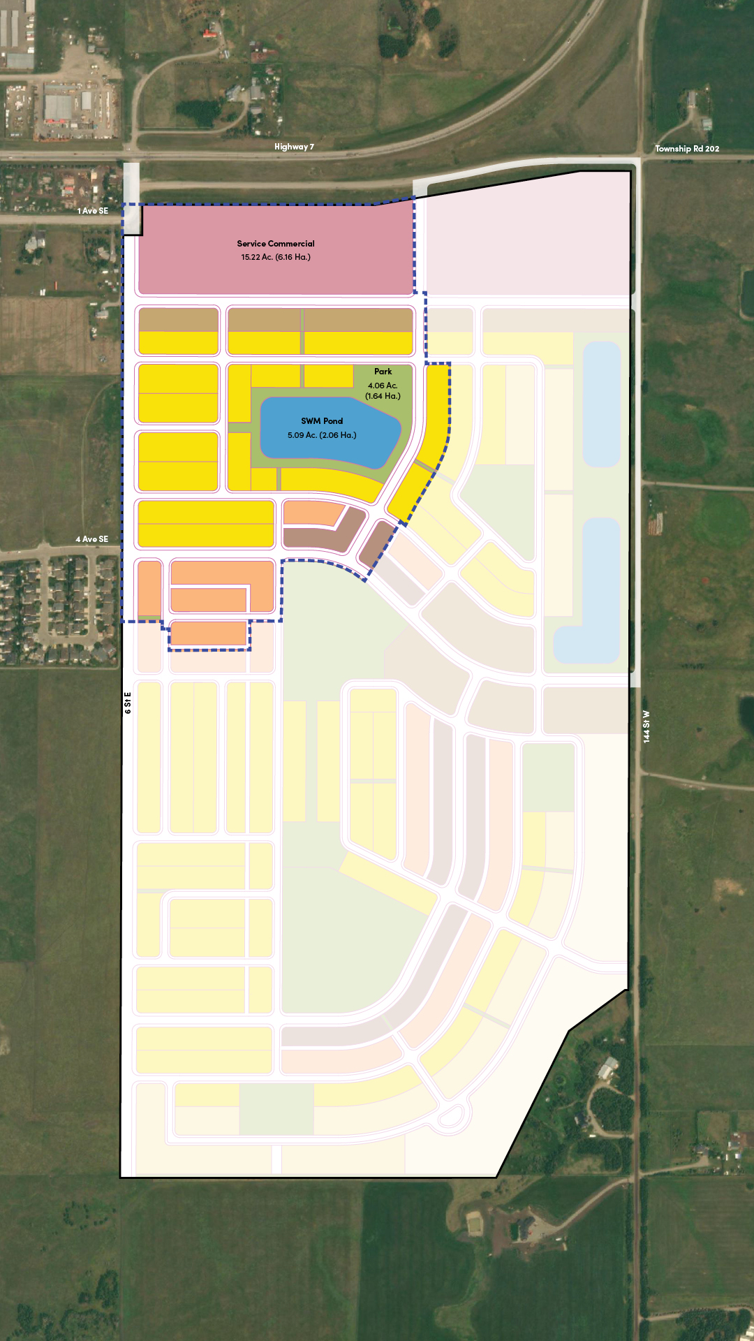
Colts Crossing ASP
301 acres / 122 hectares
Total Housing Units
• Anticipated: 1531 units • Maximum: 2041 units
Phase 1 Area
56 acres / 23 hectares
Total Housing Units
• Anticipated: 364 units • Maximum: 491 units
Typologies
Single and Semi-Detached Residential District
- This land use district accommodates single-detached and semi-detached housing.
- Public engagement identified that affordability was a key concern. Narrower lots result in a more affordable housing form.
- Lot widths: 34’ for Single, 30’ for Semi-Detached.
Multiple Dwelling Residential District
- This land use district accommodates housing forms such as semi-detached, townhouses, rowhouses and apartment housing.
- The diversity of housing types will suit the needs of different age groups and household compositions in the community of Colts Crossing.
- Lot widths: 25’ for Townhouse – Semi-Detached, 20’ for Townhouse – Apartment.
Service Commercial (SC) District
- This land use district is intended to provide flexibility for commercial and light industrial use, as well as professional offices and manufacturing.
Municipal Reserve (MR) District
- The Municipal Reserve (MR) at the middle of the Plan area is being proposed for parks and open space.
- This central open space will include a public park with amenities for residents to enjoy – such as a playground, trails and pathways surrounding a stormwater pond.
GET INVOLVED
Do you have comments? Questions? We want to hear from you!
Also, stay tuned and don’t forget to join our mailing list to receive email updates!
SUBSCRIBE TO
OUR MAILING LIST
We invite you to sign up for our mailing list to stay
up to date with the construction process.
